The East Yellowstone Loop between Cody and Yellowstone is an Epic Route that Brings Abundant Sightseeing Adventures
CODY, Wyo., Sept. 10, 2024 – With a direct route to two of Yellowstone National Park’s five gates, Cody, Wyo. is a prime starting and ending point for road trippers visiting the world’s first national park. Especially if road trippers who enjoy stunning views, historic sites and a little quirk in their car travel.
That’s because Cody – a proudly quirky destination on its own (none of the other Yellowstone gateway towns are named for a famous showman with links to Queen Victoria of England, after all) – is the start and end point for the East Yellowstone Loop. One of several scenic loops that travel through and around Cody, the East Yellowstone Loop includes two National Scenic Byways – the Buffalo Bill Scenic Byway leading to the East Gate of Yellowstone and the Chief Joseph Scenic Byway leading to the Northeast Gate. Cody is the only Yellowstone gateway town that has direct access to two of the park’s five gates.
Two Scenic Byways Along the East Yellowstone Loop
The Buffalo Bill Scenic Byway, or US Highway 14-16-20, is a 27.5-mile route that is part of what travelers and locals alike simply call the “Road to Yellowstone,” a 52-mile route between downtown Cody and the park’s East Gate. The road follows the North Fork of the Shoshone River as it passes historic buildings, rustic dude and guest ranches, stunning rock formations and rich wildlife habitat.
The route from downtown Cody to the Northeast Gate is approximately 80 miles, and it includes the mountainous 47-mile Chief Joseph Scenic Byway. This byway offers breathtaking mountain views and features historic sites and landmarks that showcase the daring route of members of the Nez Perce tribe as they evaded the ruthless pursuit of U.S. Cavalry riders on a mission to move them to a reservation. Starting in Cody, the winding route showcases some of the prettiest mountain views in the state, passes historic sites and crosses the highest bridge in the state, Sunlight Creek Bridge.
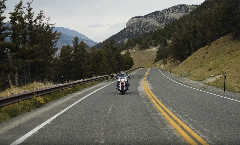
“Road tripping to Yellowstone is a classic vacation for travelers from around the U.S. and Canada,” and the scenic byways along the East Yellowstone Loop make car travel extra special,” said Ryan Hauck, executive director of Cody Yellowstone, the marketing arm for the region that includes the towns of Cody, Powell and Meeteetse, parts of the Shoshone National Forest and a large swath of Yellowstone National Park. “You never know what your day will bring. You can pass by a herd of bison and see a grizzly running along a river, stop at a historic site, see some serious mountain vistas and observe downright freaky rock formations. Passengers will want to keep the binoculars handy, and drivers will want to be extra cautious as they navigate these stunning roadways.”
TravelStorys Audio Tours – Like Having a Guide in Your Car
There are an overwhelming number of historic sites and notable places along the East Yellowstone Loop, and one of the best ways to learn about them is by downloading a free app called TravelStorys, with GPS-triggered audio tours of the Road to Yellowstone and Chief Joseph Scenic Byway. Once downloaded and started, a narrator will describe the sights and sites as drivers pass them.
What to See Along the Way
Chief Joseph Scenic Byway:
- Parkitecture at the gate. Built in 1935, the park’s Northeast Gate is one of the oldest structures in the park, and it is considered an excellent example of “Parkitecture,” a rustic style that the National Park Service (NPS) promoted in the early and mid-20th century. Advocates of Parkitecture sought to harmonize buildings and the natural environment by emphasizing natural materials like lodgepole pines and hand-crafted features that de-emphasized the symmetry that characterized other industrial era buildings.
- Wyoming’s highest bridge. Built in 1985, the Sunlight Creek Bridge features a pedestrian walkway with views of Sunlight Creek more than 285 feet below. The creek flows east through Sunlight Basin and Sunlight Gorge and eventually feeds into the Clarks Fork of the Yellowstone River to the northeast.
- Sunlight Basin. This deep, narrow gorge is where a small group of prospectors became lost in an unrelenting fog early in the 1800s. The group eventually wandered into a vast open area that was drenched in sunlight, prompting one of the prospectors to declare that the only thing that can get into the valley is sunlight. He was right about the sunlight but wrong about the gorge. It’s a basin, which is like a bowl with sides higher than the center, a rare geological formation – valleys are much more common – and one of the best-known basins in the world.
- Flight of the Nez Perce Scenic Overlook. Travelers along the Chief Joseph Scenic Byway will cross many of the paths the Nez Perce took as they tried to escape the U.S. Cavalry in 1877, traveling more than 1,100 miles. One of the best places to learn more about the tragic pursuit is at a scenic overlook, where interpretive signage showcases the path and tells the story of the dramatic event.
- Heart Mountain Rock Avalanche. The northeast corner of Yellowstone National Park was the site of a massive volcanic eruption more than 49 million years ago during which mountain-sized blocks of rock were blown more than 30 miles away from the collapsed volcano and into the Sunlight and Clarks Fork areas. Called the Heart Mountain Detachment or the Heart Mountain Rock Avalanche, the event was the world’s largest terrestrial landslide ever.
- Pilot Peak and Index Peak. At the northern end of the Chief Joseph Scenic Byway, where the road meets the Beartooth Scenic Byway junction, two massive peaks tower in the sky. The tallest of the two is Pilot Peak, elevation 11,708 feet. Index Peak is to the north, with an elevation of 10,709 feet. Pilot Peak is one of the most difficult peaks to climb in the Absaroka Mountain Range because it summits in a sharp pinnacle with no easy route to the top.
Buffalo Bill Scenic Byway:
- Cedar Mountain – Just five miles from Cody, this 7,890-foot peak, sometimes called Spirit Mountain, was beloved by town founder Buffalo Bill Cody, and it was there that he wanted to be buried. When he died in Colorado in 1917, however, his estranged wife Louisa accepted $10,000 from the city of Denver and the publisher of The Denver Post so the city could bury the still-famous Wild West Show performer in Denver instead of Cody. The funeral was heavily publicized. What happened next depends on who you ask. Many people in Cody believe that Buffalo Bill’s friends traveled to Denver, switched the bodies and secretly re-buried Buffalo Bill atop the mountain that overlooks the town he founded.
- Mummy Joe – Located just a short hike from the road north of the Shoshone River in Wapiti Valley, a Cody resident discovered a cave with the remains of a remarkably well-preserved, 1,200-year-old man that residents dubbed “Mummy Joe.” The 1957 discovery was remarkable for many reasons. He was buried under a massive overhang of a high volcanic cliff more than 6,000 feet above sea level, which offered the perfect climate for long preservation. Joe, archaeologists have surmised, was a big-game hunter, because there were thousands of well-preserved animal bones — probably of bighorn sheep and deer — resting alongside Joe’s remains. There were also perishable materials like arrows, feathers, baskets, beads and nets. Mysteriously, the cave was occupied for many years after Mummy Joe died, which begs the question of why the cave residents didn’t move the mummified remains.
- Smith Mansion/Crazy House – The Smith Mansion, which locals call “Crazy House,” is a rambling five-story structure perched on a hill on the south side of the Buffalo Bill Scenic Byway. Owner Lee Smith built the structure bit by bit over many years. Smith and his wife raised two children there, and Smith continually worked on the house, adding architectural elements like seemingly random exterior staircases and containers made from metal scraps. On a windy day in 1992, Lee was working on the upper floors without safety tethers. He fell from the roof and died. After the family moved out, the house was left to slowly decay in the harsh elements. On some windy day, it may crumble to the ground. Until then, it sits abandoned on a lonely spot overlooking the highway.
- Pahaska Tepee – This stop, located just outside the East Gate, includes a terrific restaurant, shop, cabins and Buffalo Bill’s hunting lodge, Pahaska Tepee. Visitors can tour the downstairs of the lodge and see artifacts, furniture and artwork that has been preserved since Buffalo Bill days.
- Shoshone National Forest – At 2.4 million acres, the world’s first national forest, Shoshone National Forest, is larger than the world’s first national park, 2.2 million-acre Yellowstone National Park. The rugged forest includes recreational adventures like mountain biking, hiking and camping.
- Firefighter’s Memorial – This 71-foot-long memorial near Blackwater Creek Ranch on the south side of the road to Yellowstone honors the lives of firefighters lost in the deadly Blackwater Creek fires of 1937. The fourth deadliest wildfire in the history of the U.S., the fire consumed more than 1,700 acres and killed 15 members of a Civilian Conservation Corps crew that battled the fire.
- Rock formations – The road to Yellowstone cuts through massive rock formations as it follows the North Fork of the Shoshone River, and Cody locals have determined that many of these formations remind them of, well, something. The formations have fun and just-plain-weird names such as Playground of the Gods, Chinese Wall, Laughing Pig, Elephant Head Rock and Henry Ford.
- Wapiti Ranger Station – Located 30 miles west of Cody in the tiny hamlet of Wapiti, the Wapiti Ranger Station is the oldest U.S. Forest Service ranger station in the U.S. Built in 1903 and in continuous operation since then, the station is a National Historic Landmark.
###
Home of the Great American Adventure, Cody Yellowstone is comprised of the northwestern Wyoming towns of Cody, Powell and Meeteetse as well as the valley east of Yellowstone National Park. The region is known for rodeos, authentic guest and dude ranches, world-class museums and recreational adventures that reflect the adventurous spirit of the visionaries and explorers who brought the remote region to the world’s attention.
Related hashtags:
#YellowstoneCountry
#CodyWyoming
#CenteroftheWest
#BuffaloBill
#Yellowstone
#ThatsWY
Media contact:
Mesereau Travel Public Relations
720-284-1512